


Contact
us

Discovery tour
Newsletter
Get tourist news on Ottignies-Louvain-la-Neuve


Pinchart Walk


Promenade No. 7: Pinchart
This tour will allow you to:
- Stroll along the Pinchart up to its source by taking the forgotten trails (81 and 85) that came to be accessible to all.
- Discover the signage that we are planning to generalize the different tours.
- Appreciate the dozen panels prepared by the members of the Nature Development Community Plan (PCDN), which aims to enhance the natural heritage.
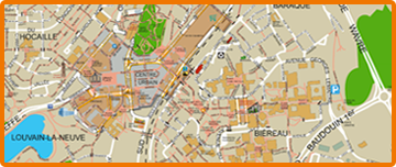
Approximately 12 km long, this tour also offers a shorter version. As with the previously published promenades, eleven numbers appear on the map. They correspond to the text displayed below. On the “P” map there are also nine PCDN panels with descriptions of the natural heritage.
1. The Buston Woods
The Buston Woods are community property. Since 1999, the City has been attempting-with various partners-to promote the three functions of the woods: fishing, the ecological function and the social function.
Enter these woods and walk around the different ponds. You may see a kingfisher, a great spotted woodpecker, a nuthatch or small frogs in one of the ponds.
2. A reserve for frogs/toads and the Lathraea clandestina
Each year, in the spring, the PCDN organizes here a batrachian rescue operation. The project consists in helping the frogs and toads travel from the woods where they live their terrestrial life and take refuge in the winter (exiting at night, in wet weather) to the ponds, where they lay their eggs.
Another particularity of these private woods is that it constitutes one of the two only sites in Walloon Brabant harboring the Lathraea clandestina (the second is located at point 10), a rare and protected plant. Despite its deep purple color, you risk not noticing it because it blooms at the very beginning of the season (from march to april), is devoid of stems and lives in symbiosis on the feet of ash trees, alders…
3. The Mill farm and the Pinchart
Traveling along the Pinchart, one learns about the “mill” type activities on the location of the current farm, since 1374. The source of the Pinchart River is in a meadow in Montaury and its confluence is in the Dyle at the height of the farm, at the bridge. There is only one fish indexed in its waters, the stickleback, a small fish of 5 to 8 am long, which testifies the average quality of the water.
4. The watercress bed
Traveling along the Pinchart, one learns about the “mill” type activities on the location of the current farm, since 1374. The source of the Pinchart River is in a meadow in Montaury and its confluence is in the Dyle at the height of the farm, at the bridge. There is only one fish indexed in its waters, the stickleback, a small fish of 5 to 8 am long, which testifies the average quality of the water.
5. The Pinchart or the “rë dë Pën’tchô” (in Walloon)
The reopening of trails 81 and 85 allows you to stroll along the wild side of Pinchart. The word “Pinchart” comes from Dutch and means “twinkling earth “.
6. Rue du Puits
Rue du Puits - which is planned to be improved - is an essential path for getting around: it easily links the center of Ottignies to Puits, Lasne or Rixensart. You can enjoy a very beautiful view of the Céroux countryside in the distance and, closer up, an old orchard. For several years, the City has replanted high stem orchards, essential for insects, birds (owls, for example) and mammals.
7. Hayettes Farm
This farm, already cited in 1482, hasn’t fulfilled its original vocation for several years. It’s there, in the meadows below, where the sources of the Pinchart are located.
8. Padri Céroux fields
From this spot, you can enjoy a very open view over the countryside of Ottignies-Louvain-la-Neuve. The borders of the paths, extensively controlled (late reaping), adorned with the beautiful colors of poppy or bindweed…
9. The Balbrire Farm
This farm was already cited in the 13th century, but the current construction dates from the 18th century. The name “Balbrire” means “Beautiful Briar”. It recalls the presence of these plants at the bottom of the valley.
10. The Try Valley Floor
The path that extends along the Pinchart Valley is often humid. In fact, it is supplied by numerous small sources that appear at the foot of the hill.
The vegetation at the bottom of the valley is composed of willows, ash trees, poplars…to which purple toothwort is associated.


Download |
![]() ArtWhere Création de site Internet - Neo-CMS Gestion de contenu CMS
ArtWhere Création de site Internet - Neo-CMS Gestion de contenu CMS ![]()