


Contact
us

Discovery tour
Newsletter
Get tourist news on Ottignies-Louvain-la-Neuve


Walk in Rofessart


Promenade No. 2: Rofessart
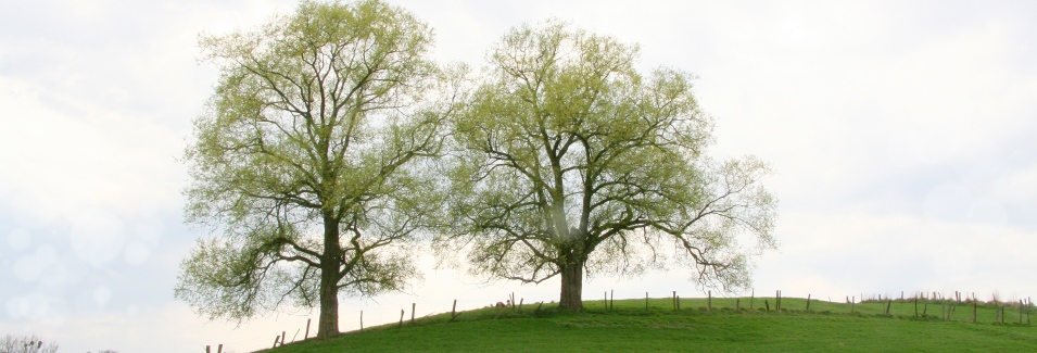
1. View of Profondsart
Departure close to the castle of Lambermont. From the parking lot of the St. Joseph church in Rofessart , take Rue Victor Sténuit. A little bit further along, facing the cemetery, enjoy the superb view of the small wooded valley.
2. The slopes of the Old Road to Brussels
After crossing a quite new district, leave the hamlet of Rofessart by the Old Road to Brussels. Several local tree species are identified on the left slope of this path: ash trees (recognizable by their black buds), acacia (with its heavily cracked bark and its young spiny branches), and the elder clusters (of which the flowers and fruit serve to make syrups). The serotinous prunus, a recently imported species in our region and recognizable by its small fruit resembling cherries (but not edible!), can particularly be enjoyed here. Further along, the wild vegetation is colored by bluebells, with its mauve bell-shaped flowers, and wild chicory, with its blue flowers.
3. Robert Chapel
At the end of this path, walk about one hundred meters on the Brussels highway before branching off at path no. 2. Once used as a connection point between Wavre and Nivelles during great floods, this path leads to the Robert Chapel. Located on the outer limits of Lasne and Limelette, this simple, blue-stone niche, dedicated to the memory of a shepherd killed during a brawl, was built next to a small-leafed lime tree.
4. Views from the agricultural plateau
After having traveled along a wall of trees masking the imposing buildings of the Belgian Building Research Institute, built on an agricultural plateau, you come across various crops: wheat, peas, beets…From there, a clear view can be enjoyed (from afar, the tower of the Céroux church, the Moriensart castle and more can be seen).
5. A magnificent, pedunculated oak
Before taking path no. 7 once called "Chemin des Veneux" [Path of the Revered], an imposing pedunculated oak can be found on the right.
6. The slopes of path no. 7
During the summer, red poppies, white chamomiles, yellow fields and daisies, mauve bluebells and yellow hawkweed are scattered among the slopes of path no. 7 in an explosion of flowers. Two recent sheds precede a replanted area of poplars. On these, a mast measures wind speed (the hope is to build a windmill there). The crimson epilobium is observed here as well as the large white comfrey. Generally indentured among humid environments, the large white comfrey was once used for its healing properties.
7. Rofessart Woods
After crossing the highway, you come to Rue du Charnois, once planted with hornbeams. From there, the Rofessart Woods mostly planted with beeches and oaks, in addition to ashes, maples, poplars, chestnut trees, hawthorns and bird catcher rowans are on the left.
8. View of the Pinchart valley
At the next crossroad, take the Rue de Lasne. After the woods, behind an enormous blackberry bush where various insects pollinate (butterflies, beetles…), there is a breathtaking view of the Pinchart valley. This vast area of meadows is a favourite spot for the American kestrel (falcon) and the sparrow hawk.
9. The southern slopes of Rue de Lasne
Lower, on the left, notice a few lizards basking in the sun.
10. At the corner of Rue des Vergers and Rue de Lasne
A beautiful alignment of pruned willows creates a small shelter for sheep from bad weather. While their former use has disappeared today, these trees are pruned regularly.
11. The slopes of Rue des Vergers
Still called the “Ugly Hole”, Rue du Verger is one of the most beautiful paths of the entity. The vegetation here is diversified. The high and large slopes are bordered with sessile oaks, wild cherry trees, black elder trees, hawthorns and spindle-trees. On the left, you can also observe a grass that is particular to these shaded areas on the poor and dry terrain: wavy hairgrass. During warm weather, this corner is appreciated for its shade and freshness. This path connects the Pinchart valley to Rofessart by Rue du Charnois.
12. The orchards of Rue du Charnois
Despite the urbanization of the road, two large orchards still exist. In addition to the aesthetic and landscape features, they offer a place for the feeding and reproduction of a large number of animal species.
13. The view from trail no. 29
This paved trail descends between the centaurea and the rooted spotted cat’s ear (chicory family). It opens on the meadows located behind Avenue Haulotte.
14. The Try Bed
This area once left as a waste land is occupied today by meadows. The area comprised between the Try bed farm and the Source of Baleau – decorated by the remarkable lime trees of Avenue de Lambermont – is also marked as a landscape interest area in the Sector Map.
15. The orchard of Rue du Baleau
In the meadow below Avenue of Lambermont and Rue du Baleau, a very well-maintained orchard presents a large diversity of upper stem plants : rennet apples, beautiful flowers…
16. The source of Baleau
This source supplies a watercress bed that is abandoned today. Nearby, you can observe a beautiful private pond.
17. The Castle of Lambermont
To find the point of departure, pass in front of the entrance to the castle. The farm was renovated in 1835 into the beautiful property that it is today, surrounded by a park of which the three common beeches that border the entrance are listed.
18. The remarkable lime trees of Rue Haulotte
You can also make a small detour by the chapel located on Rue Alfred Haulotte, bordered by two remarkable lime trees.


Download |
![]() ArtWhere Création de site Internet - Neo-CMS Gestion de contenu CMS
ArtWhere Création de site Internet - Neo-CMS Gestion de contenu CMS ![]()